Here are a several amazing infographics of NYC, reflecting the building height in relation to land value, and mapping Manhattan's development index, according to price per square foot and zoning regulations in relation to property values. This come from a fantastic data visualization blog, with quite a few fascinating cartographic representations.
Two Dimensional representation of (3 dimensional) building heights.
 |
Bill Rankin, 2006
 |
|
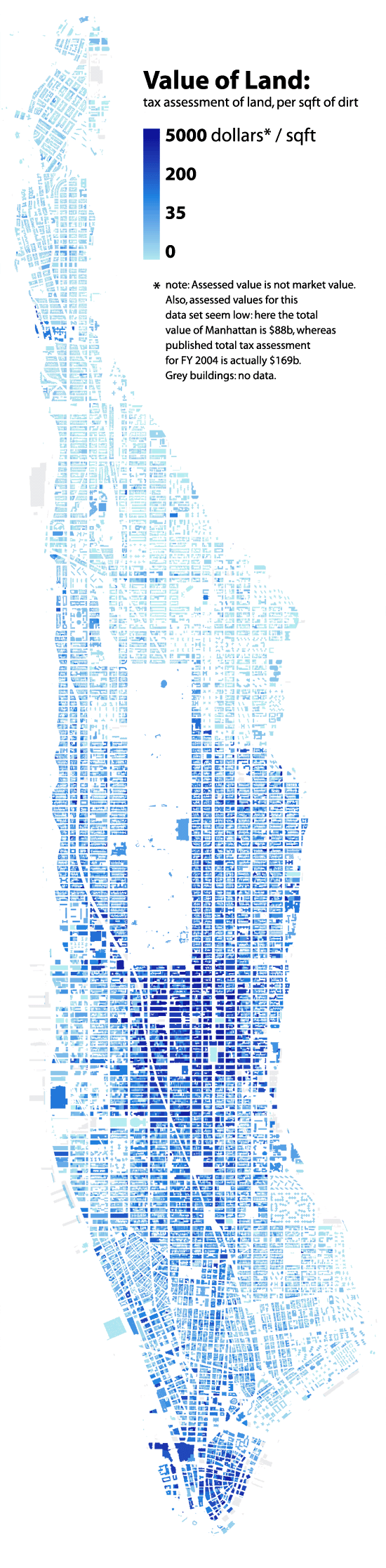
LAND VALUE Bill Rankin, 2006 "Tax assessments are a tricky data source, since they do not measure market value — indeed, there are even tax-assessed "values" on public buildings and parks. (Here Central Park is "valued" at $1.9 billion.) But they do give a rough sense of relative values within the city: the pocket of wealth up near the cloisters, and the relative sparseness of the lower east side. Note: even though this map shows building footprints, the land value shown for each building is per square foot of lot size."
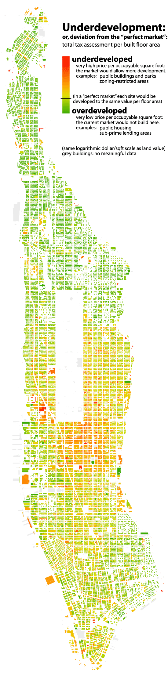
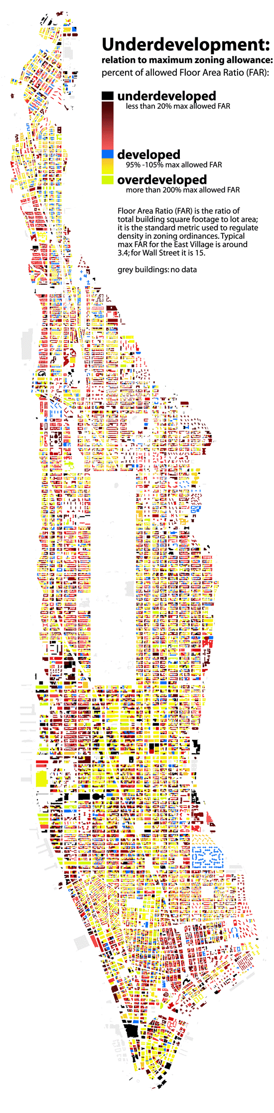
UNDERDEVELOPMENT 1: Bill Rankin, 2006 In a hypothetical "perfect market," this map would be a consistent yellow-green. Every lot would be built up precisely in accord with its land value. Lots which were underdeveloped would be torn down and built up again with higher densities. Overdeveloped sites would lower the price of nearby lots, again establishing equillibrium. But government distorts the market (often in very good ways), by building low-density public buildings and monuments in central areas (e.g., the Public Library or Lincoln Center), or building public housing that the market would not otherwise provide (see the lower east side). Zoning also restricts development for the sake of light, air, and congestion. Notice the difference between Midtown and Wall St.: Downtown looks very close to a "perfect market," while Midtown seems restrained by zoning. Notice also underdevelopment along Madison Ave. and Broadway, and the (thankfully) "irrational" presence of churches throughout the city. Note: See also methodological notes about tax-assessment data on the Land Value map.
|